Deadwood Camp Gedenksboek 1901
Sights around St Helena
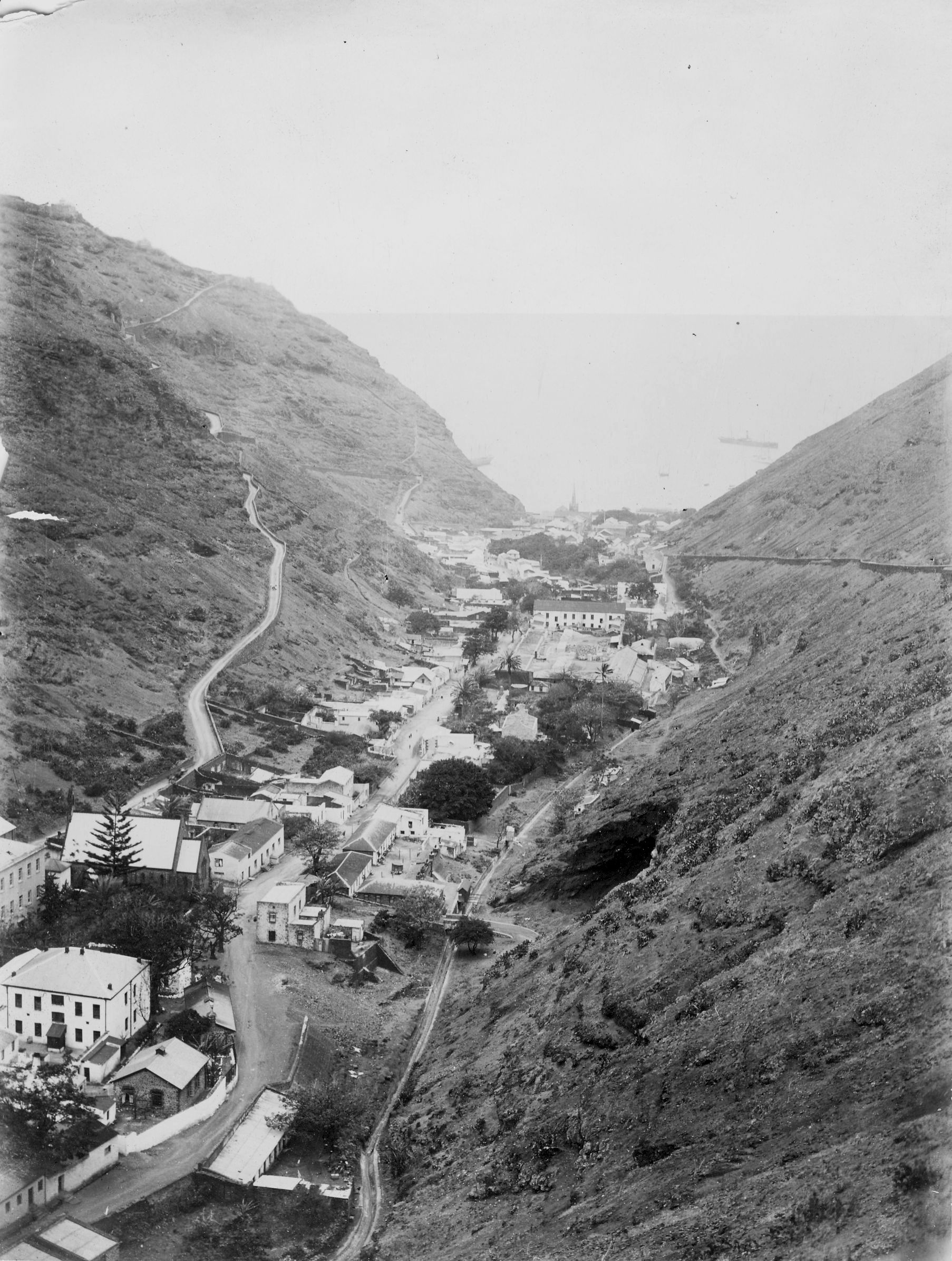
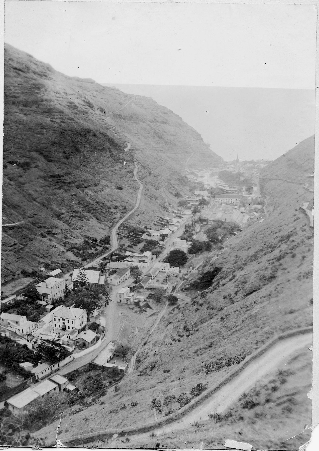
Jamestown.
(Editors note - On St Helena there are three major access points to the sea, namely Jamestown, Rupert Valley and Sandy Bay. Access is via valleys as most of the population live 200 meters above sea level. Highest point on St Helena is 823 meters. This is a view of Jamestown from the top of the valley showing the roadstead
in the distance.)
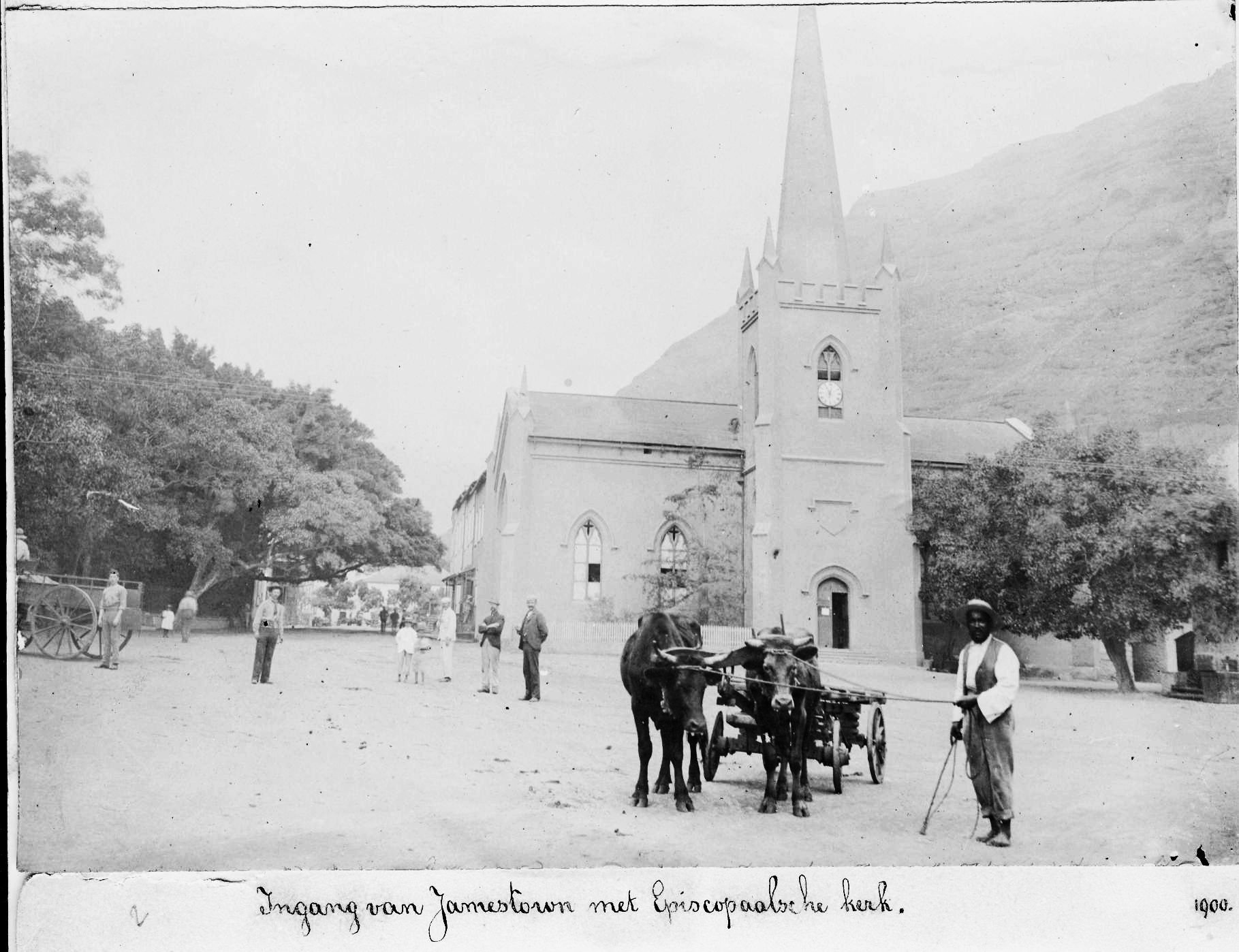
Entrance to Jamestown with Episcospal church (1900)
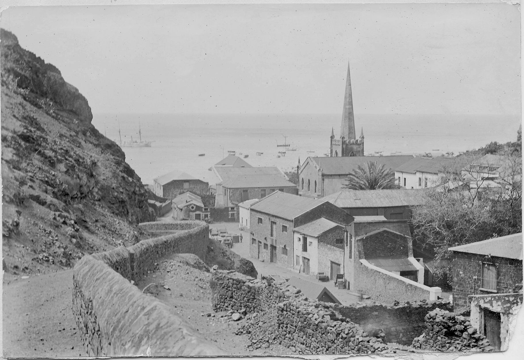
Jamestown.
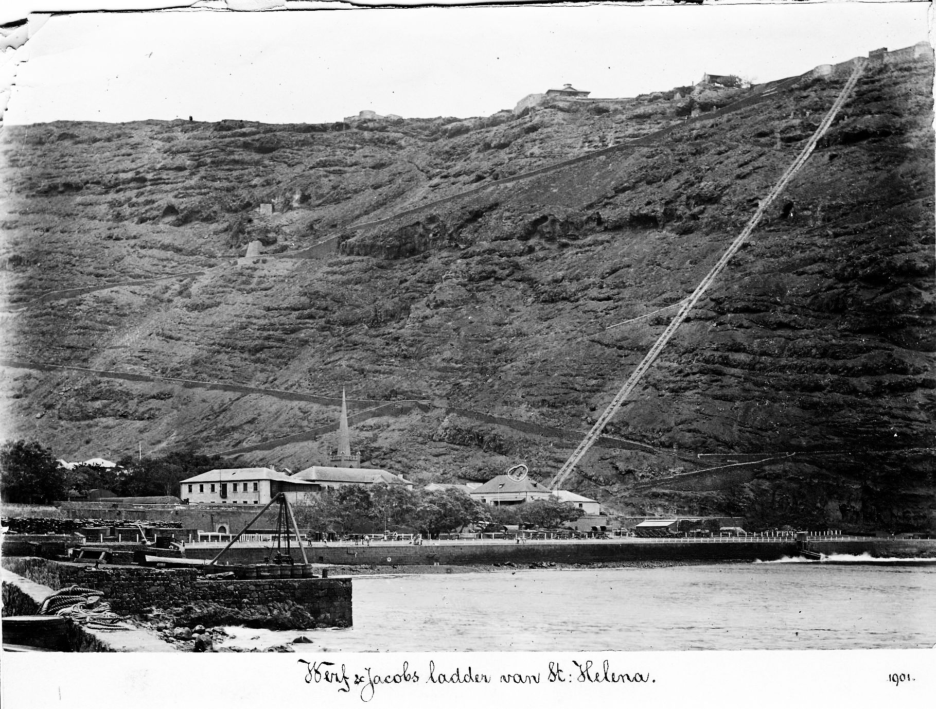
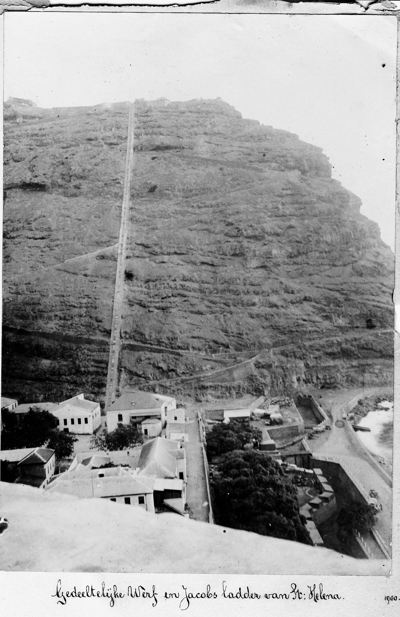
Wharf and Jacobs ladder(1901)
(Editors note - The Jacobs ladder is all that remains of a cableway that ran from Jamestown to the Fort. In 1829 St Helena Railway company built a two car inclined plane cableway to carry cargo between Jamestown and the fort (never carried passengers). By 1871 the wooden sleepers had been eaten up by termites and removed by the Royal Engineers together with the rails and cars. All that remains is the 700 (699) step ladder for pedestrians linking Jamestown to the area of Ladder Hill on the top of the hill.)
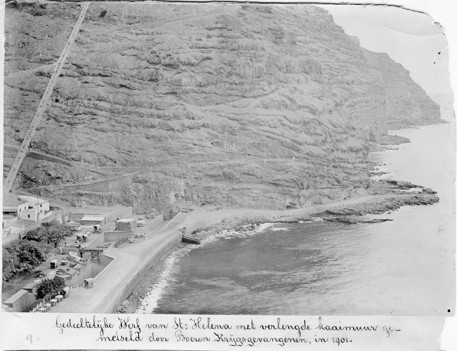
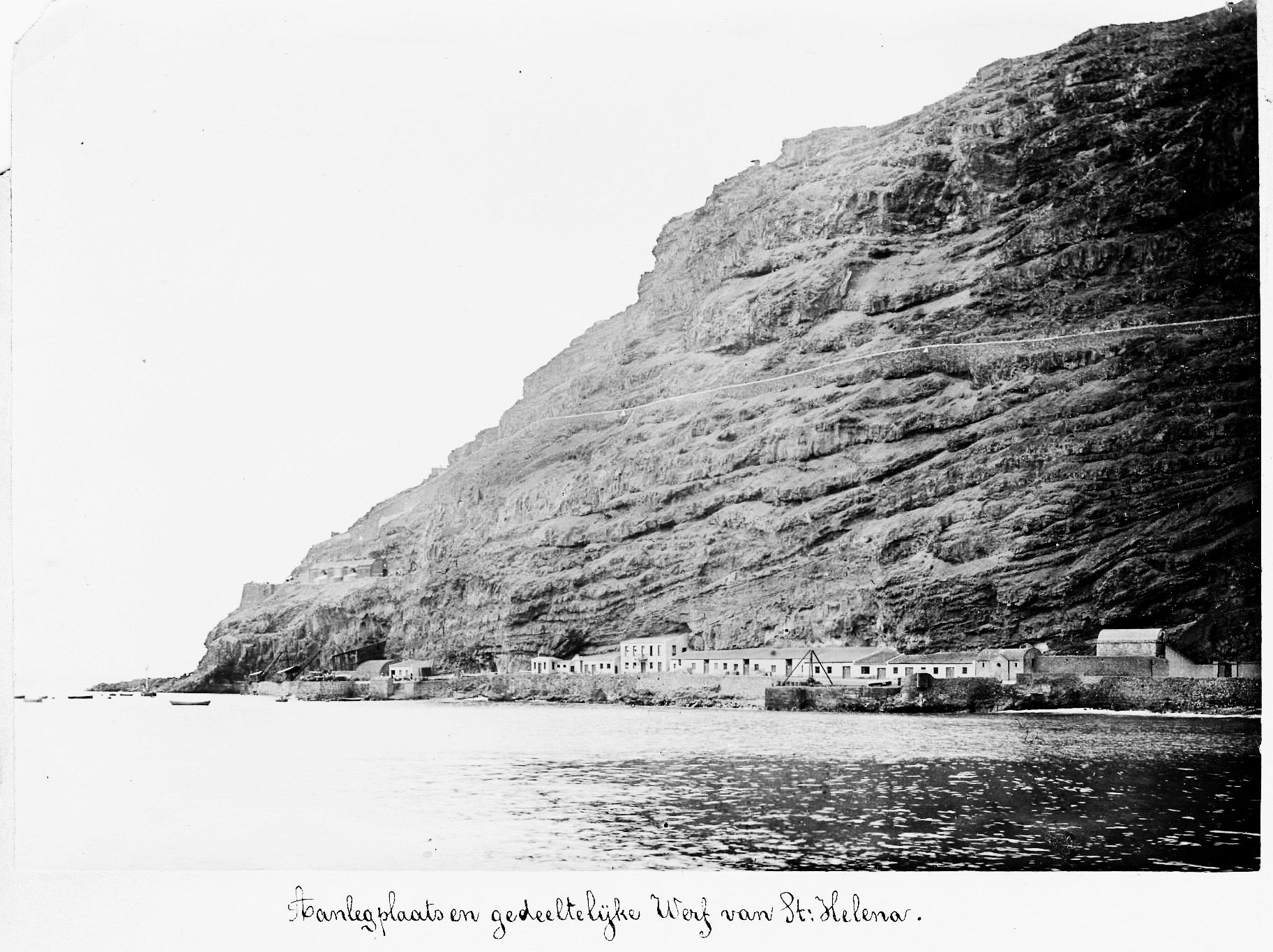
Partial naval yard at St Helena: quay extended by Boer PoW
builders in 1901
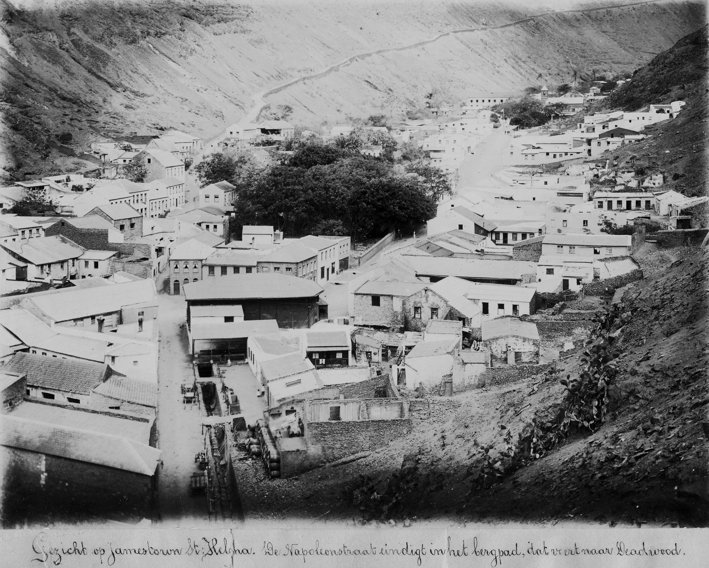
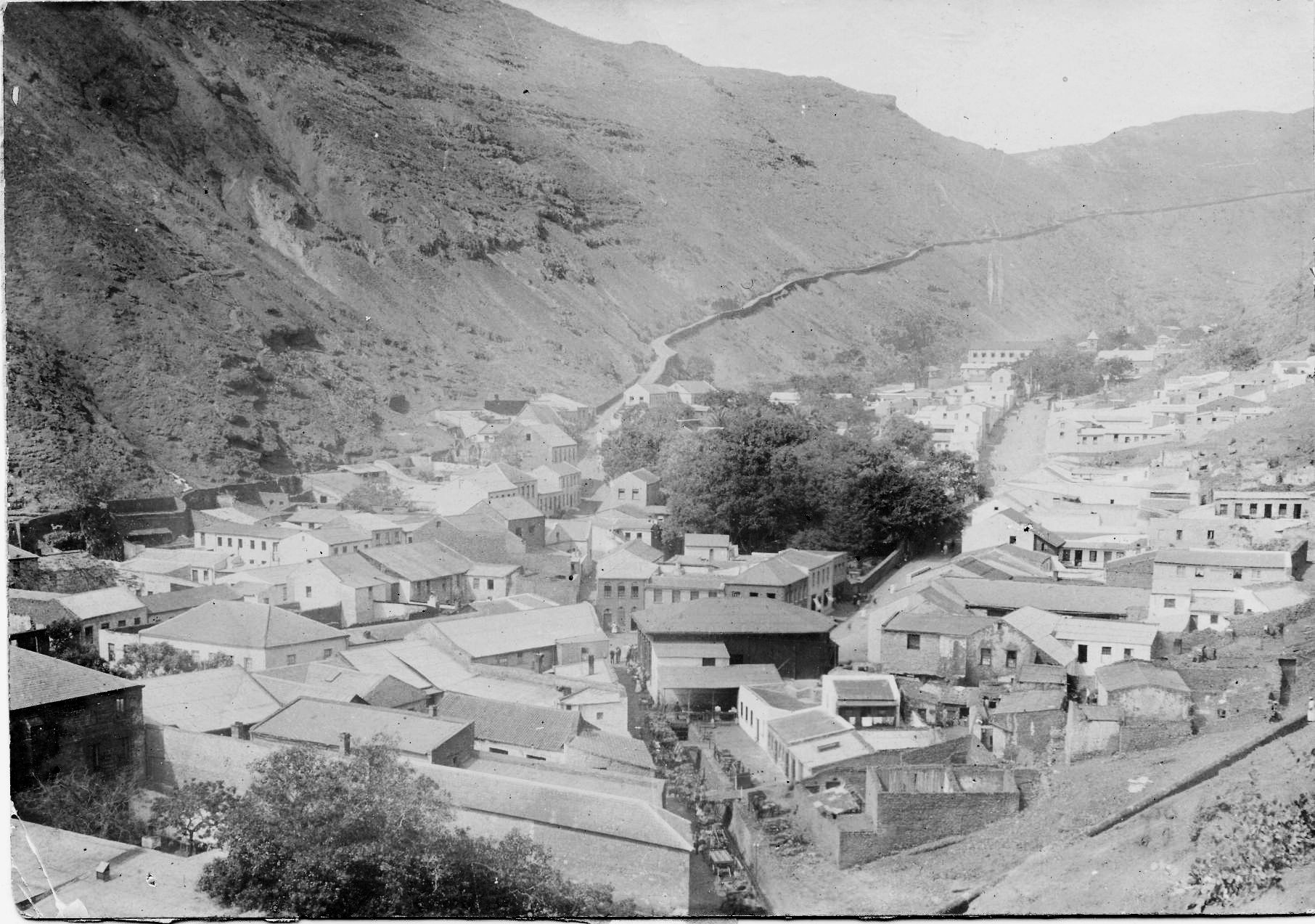
View over Jamestown. Napoleon Rd ends in the mountain
road which goes on to Deadwood
(Editors note - St Helena Museum comments -The road from the bottom of the picture to the centre in fact Back Way. Napoleon St is the road running from top left and as the caption tells us, joining Side Path Road, which runs up the bare hillside at the top. The photo shows what appears to be a cooperage in the foreground, next to the ruins. The "canal" running along Back Way is what we call The Run, a stone lined watercourse that does just that from the top of town to the sea. It actually runs under our Museum before reaching the seaside.)
Jamestown
Partial wharf and Jacobs Ladder St Helena
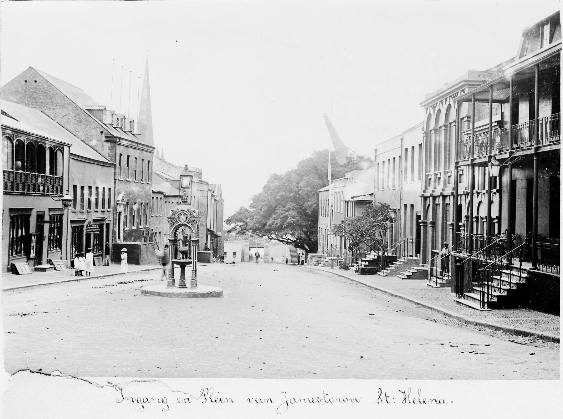
Entrance to town square in Jamestown
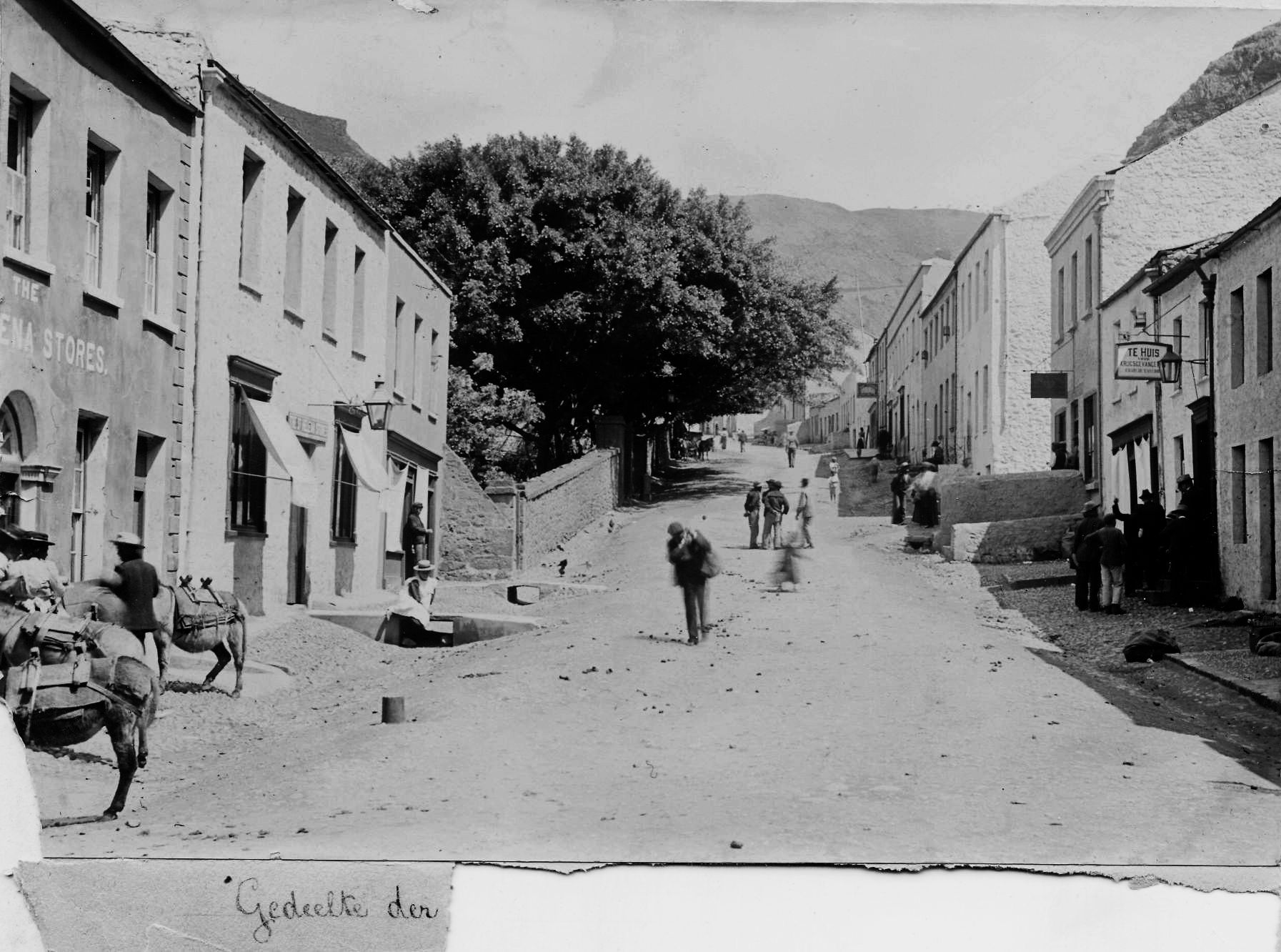
Part of Jamestown
(Editors note - St Helena Museum comments - This is the bottom end of Market Street as seen from the Market. The building on the left with the arched door is the St Helena Stores in your photos. I remember it as a general store in my early days. Next door to it is a shop known as Tinkers. (Tinker's Store). On the other side of the street, the sign "Te Huis" is a club and cafe for the Boer prisoners, so presumably a cluster of Boers outside. (If one refers to De Krijgevangene No 10 you can see an advert for the menu and prices at Te Huis/At Home). Above that with the black sign is the Rose & Crown pub. It was the house of Saul Solomon in Napoleon's day.)
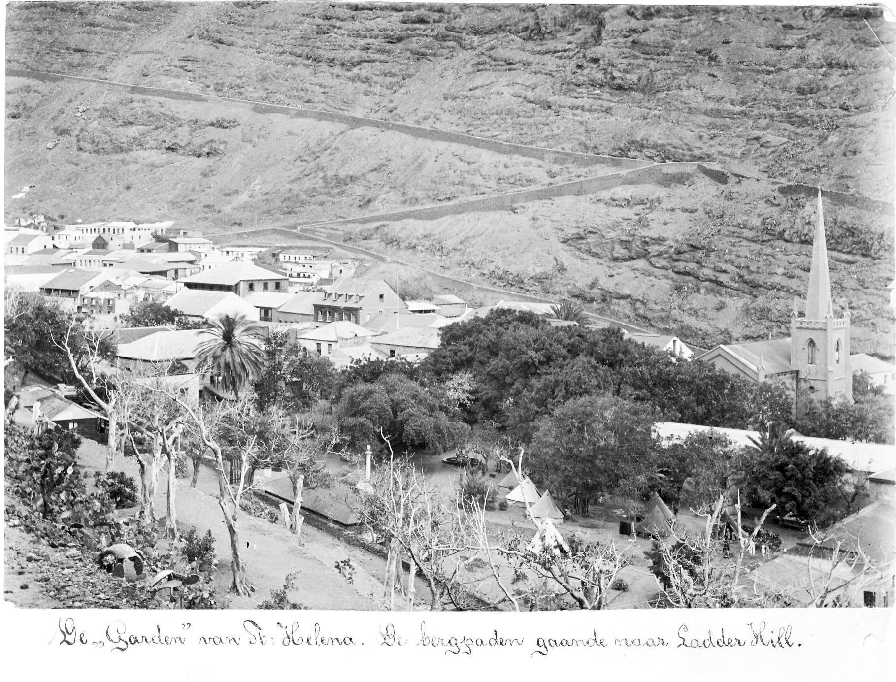
The Garden of St Helena. The mountain garden near Ladder Hill.
Jamestown
(Editors note - St Helena Museum comments - This photo was taken a long time before the photo entitled "Napoleon Road" above. The Back Way is blocked and the canal has not yet been built. There isn't quite enough resolution to see what is actually going on. It looks like some sort of street market. The black building just above is the Market, so it could be some sort of overflow. On the other hand it may be stacks of goods waiting to be moved into warehouses to the left of the road. )
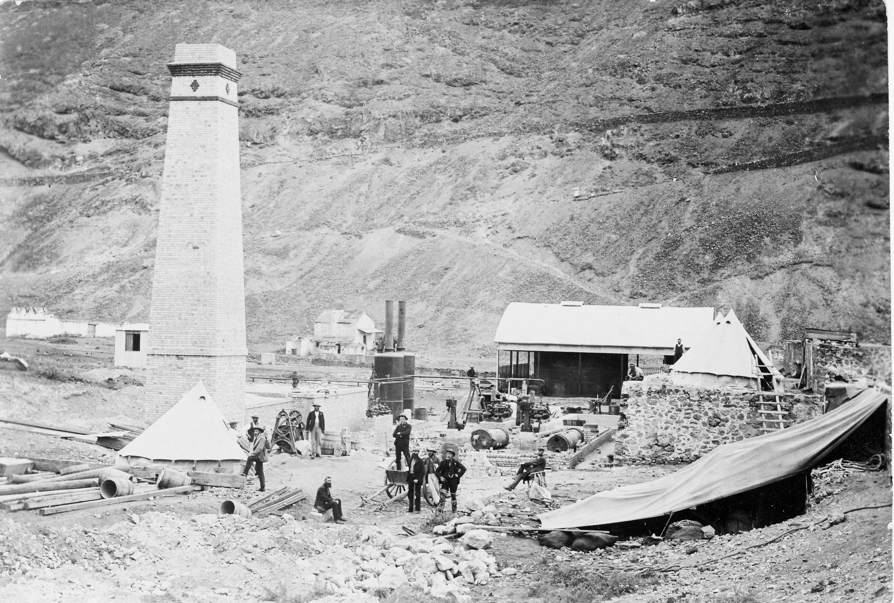
Ruperts Valley on the Lee side St Helena August 1901
(Editors note:- The chimney is part of the desalination plant that was under construction. The Boers were involved in piping the water to the interior. The chimney still stands at St Helena)
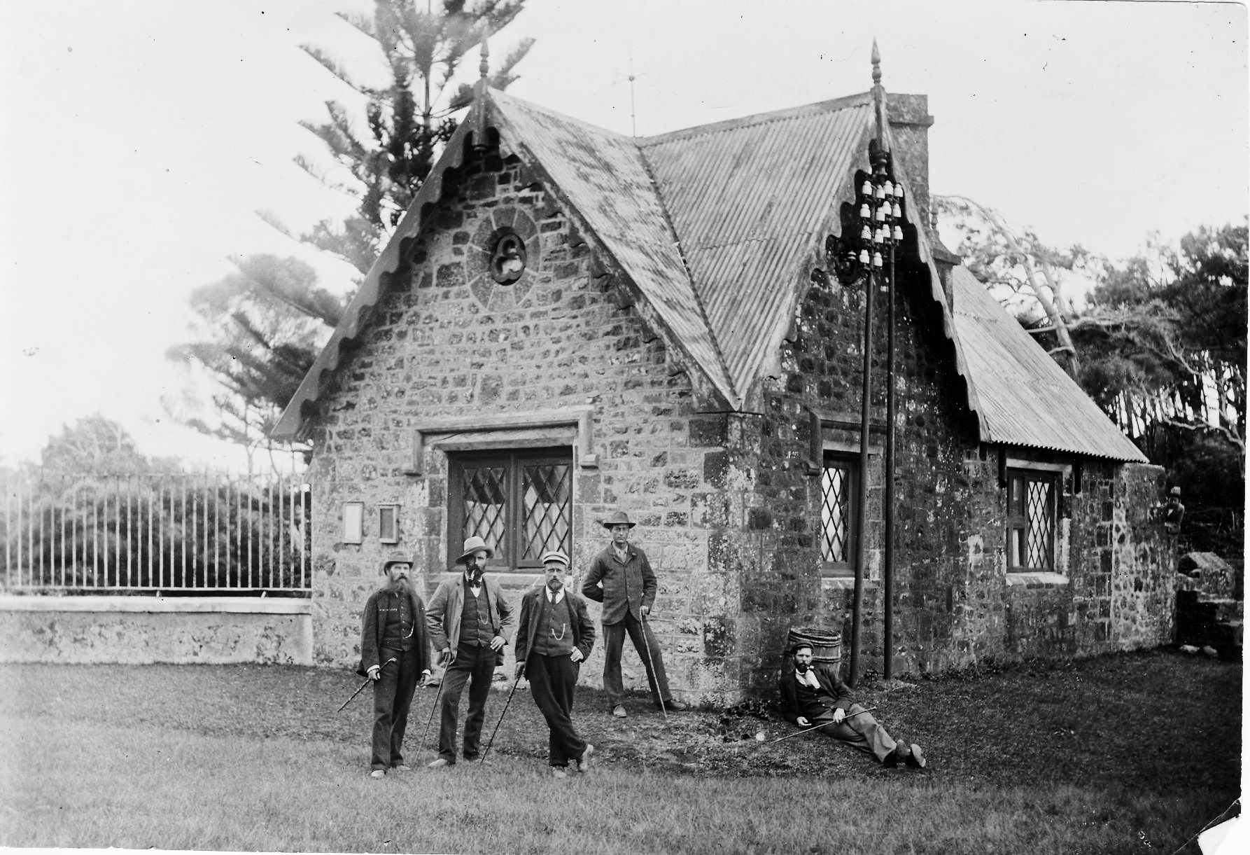
(Editors note:- One of the gatehouses to Plantation house, the Governor's residence, which was used as part of the Island's internal telegraph and telephone network.)
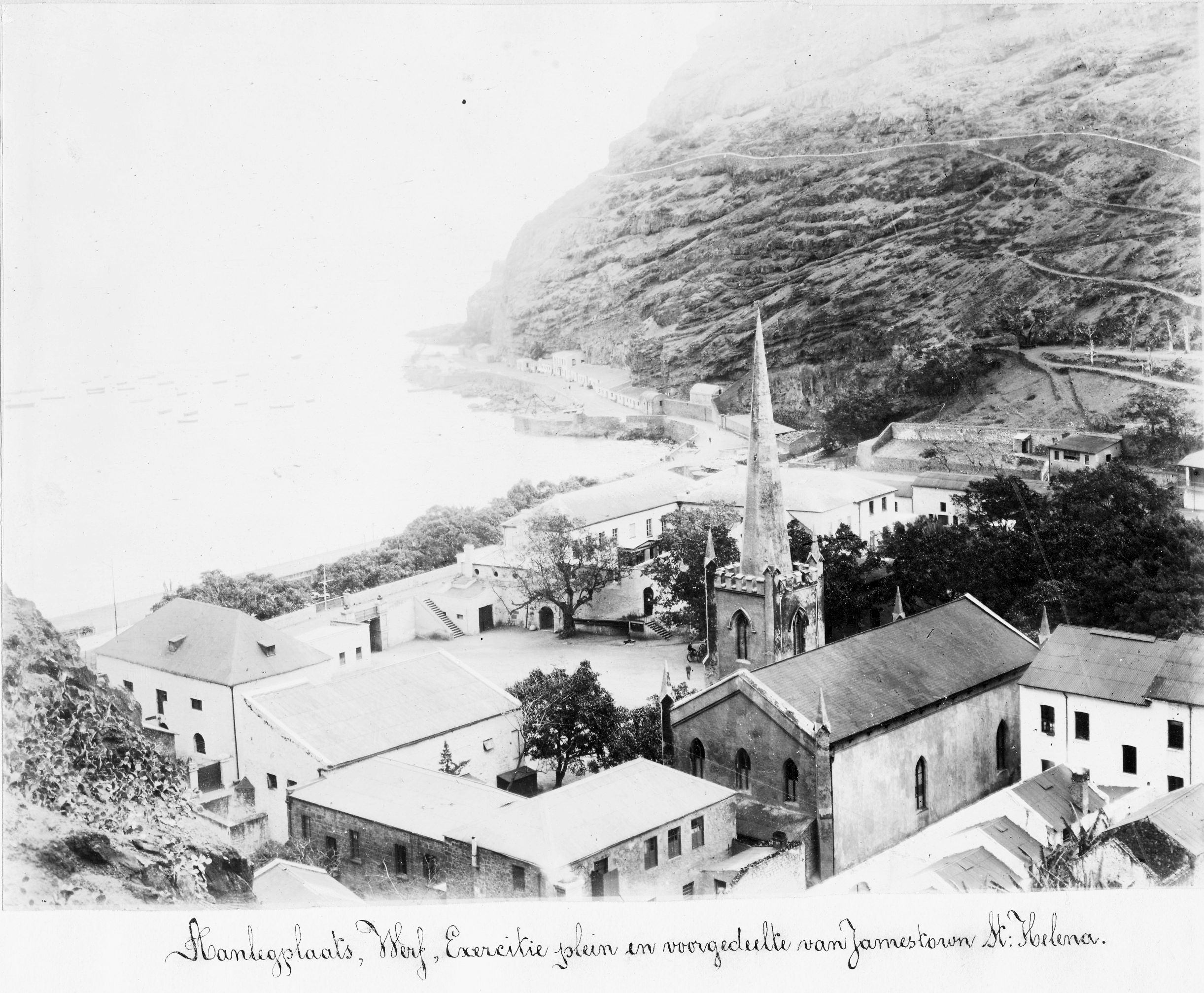
Roadstead, wharf, exercise square and front of Jamestown
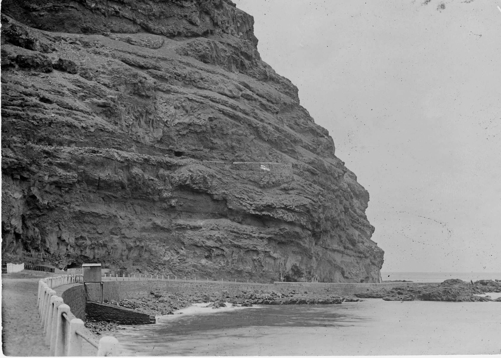
Roadstead and partial wharf at St Helena
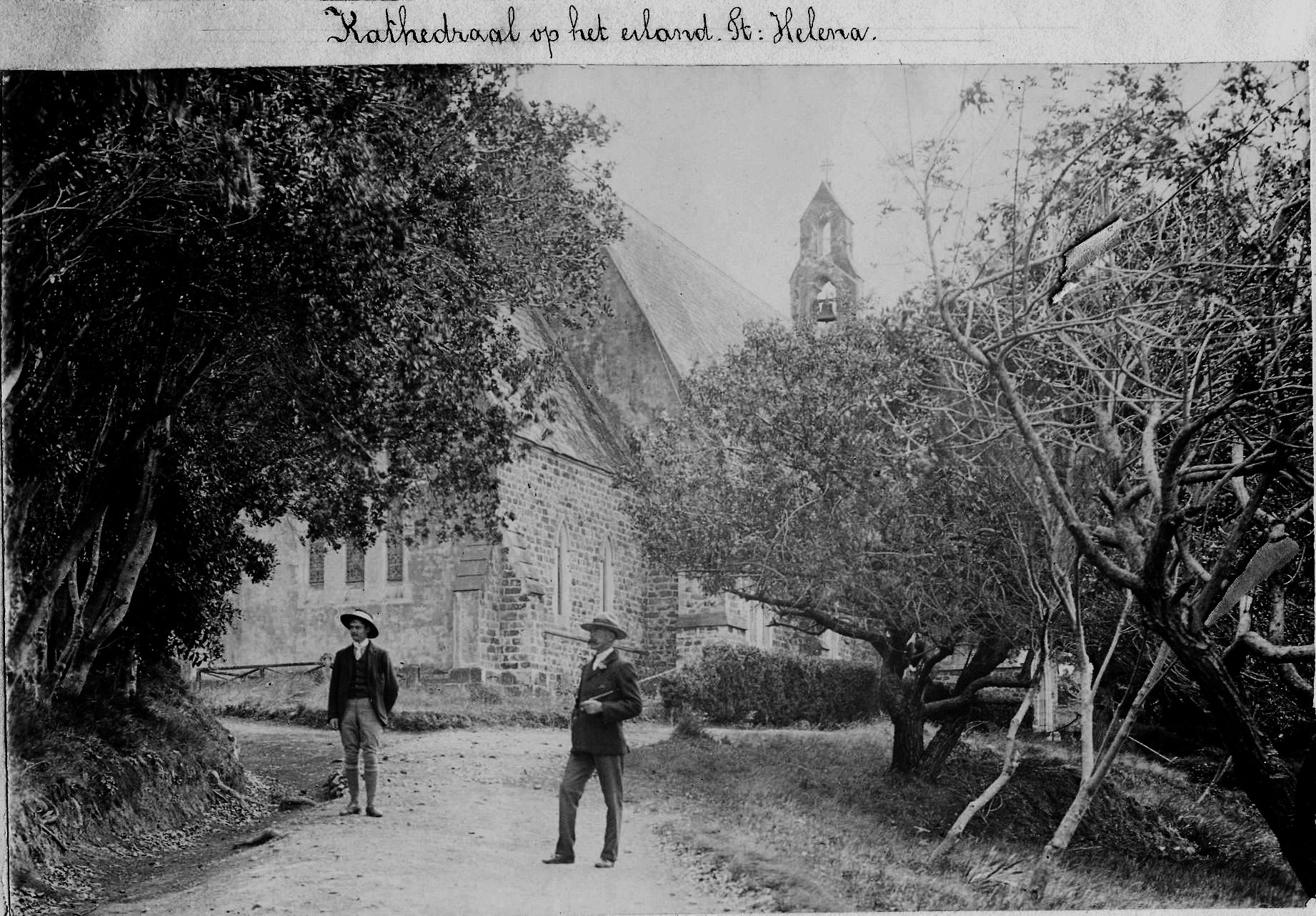
St Pauls Cathedral in St Pauls on the island St Helena