
NO PATHWAY HERE
by John H Marsh
CHAPTER II
THE ISLANDS
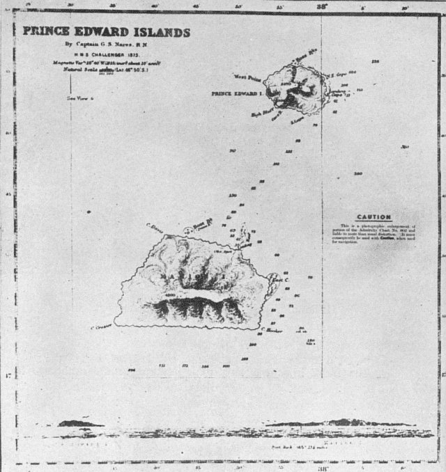
THERE were not many aboard the Transvaal who had heard of the Prince Edward Islands. There were proportionately fewer in the Union of South Africa who were aware of their existence. They are so small and unimportant to the world as a whole that few map-makers trouble to mark them on their maps. You need a maritime map to be sure of finding their position. Look south-east from the Cape into the Southern Ocean that separates the populated land masses of the world from the Antarctic Ocean and its frozen continent, and there, nearly 1,200 miles away in your line of sight, lie the Prince Edward Islands. Turn and look east towards Australia. You might say the Prince Edward Islands lie roughly one-fifth of the way across; the Crozets, two-fifths; and Kerguelen, three-fifths-all in a line on about the same parallel, but well to the south of that parallel that joins Cape Town and Sydney.
Though comparatively few folk ashore have even heard of them, the Prince Edward Islands are known to and feared by quite a large number of ocean voyagers. Not many have seen them, and few ever want to. They thrust their lava peaks out of that vast sea where the world's wildest weather is born. Their name is synonymous with storm, disaster and death. The islands are the nearest to South Africa, excluding those within sight of its shores. The shortest distance between them and the Union's seaboard - near Algoa Bay - is about 960 miles. There is no other large land mass closer to them than the ice-fringed Antarctic Continent itself - distant 1,200 miles. Within a radius of 450 miles from the Islands nothing else breaks the surface of the sea. Then, to the eastward, you get the
Crozet Islands and 750 miles eastward of that again, Kerguelen.
All three island groups stand upon a single plateau rising a mile high from the sea floor, which is three to three-and-a-half miles below the surface. They are the highest peaks of a huge subterranean mountain range. This range runs roughly east to west, and its principal peaks emerge from the ocean between the 45th and 50th parallels of latitude. They are solitary sentinels in the playground of the "Westerlies" - those boisterous winds that blow almost unceasingly from west to east along a broad ocean pathway that girdles the bottom of the world. The only land barriers that impede the winds' free flight are the fingertip of South America and the narrow strip of New Zealand. The few island peaks placed along the pathway are but stubbing-stones that draw upon themselves the full wrath of the elements. To geologists they are the outcome of subterranean volcanic action - one-time air-vents in the earth's crust. To the elements they are mere intruders in a No-man's-land where wind and weather claim undisputed sway.
Nature seems to have been at pains to maintain the exile of its orphan islands by creating between them and the inhabited lands of the earth the barrier of the "Roaring Forties". In this zone that circles the earth just to the north of the domain of the "Westerlies", the wind is never still or constant in direction, and the sea invariably reflects its restlessness. Fog and ice add to the dangers that confront mariners venturing into such high latitudes. They keep well clear of them unless there is good reason to go that way.
It was good reason, but harsh fate, that tempted the first man down to the Prince Edward Islands. The price of his discovery was the cost of his life. Marion du Fresne was searching for the great land mass which geographers of his day (the latter half of the eighteenth century) insisted must exist at the bottom
of the world in order to balance it on its axis. There were other explorers also engaged in a race to find the mysterious Antarctic continent. Captain Cook was pre-eminent among them, but France was also prominent in the field with others besides Marion and his colleague, Chevalier Duclesmeur, both of the French Navy. One of the other French explorers who was to stamp his name in the Southern Ocean about that time was Kerguelen-Tremarec.
Marion, who was in charge of the surveying expedition and commanded the frigate Le Mascarin, and Duclesmeur, who commanded the frigate Marquis de Castries, saw what were to become known as the Prince Edward Islands for the first time on January 13, 1772. Their vessels raised above the skyline what at first looked like two icebergs. As they drew nearer they made them out to be snow-capped peaks. The northernmost one soon proved to be an island. Haze hid the other from full view, but it was apparent that it rose considerably higher than the island and was covered with hills in double and triple ranges, their summits capped with snow.
The charts of the day showed no land near here, though a Dutch chart prepared by Van Keulen, some fifty years earlier, showed the islands of Marseveen and Denia some distance away, in latitude 41 degrees South. To these the Cape governor, Adrian van der Stel, had as far back as 1699 ordered the Dutch vessel, Wezel, to fetch timber for the Cape settlement. There is no record of her having brought back any. Nobody had since reported having seen those islands, and if they existed at all they were probably those on which Marion was now gazing, wrongly positioned on the chart.
In the excitement of this discovery Marion was convinced that he had at last come upon the long-sought Southern Continent. To this land whose extent was hidden by the haze he therefore gave the name of "Ile de l'Esperance" (Isle of Hope). To the island
north-east of it he gave the name "Ile de la Caverne", from the large cavern in the base of a cliff, which he observed on the eastern side. A channel about 12 miles wide separated the two. Marion was anxious to land and explore as soon as possible. The elements, however, combined to prevent such an intrusion. The wind changed direction and quickly raised enough sea effectually to prevent a landing on the coast of the "continent." After wasting a day Marion took his ships across to the island in the hope of landing there. But before the day was out he learned something of the treacherous nature of the waters in which he was navigating. Both ships struck the ground and were damaged, and sudden blasts of wind swept away the bowsprit and one mast of the Marquis de Castries and some of the sails of Le Mascarin. Marion had to postpone his proposed landing while repairs were made.
For five days in all the French made unsuccessful
attempts to find a safe anchorage and to set foot on this
new territory. The weather was constantly against
them, however, and eventually Marion gave up his
plans and squared away his ships towards the east.
By that time he had discovered that what he thought
was part of the Southern Continent was in reality only
another island. In disgust he changed the name of
the group to "Iles des Froides " (The Frigid Islands).
A week later Marion came upon another group of
islands. Having satisfied himself that these also were
not part of the continent he sought he sailed on east
again. Eventually he reached the land that subsequently
became known as New Zealand. There he was
massacred by the Maoris.
By coincidence on the very day that Marion discovered his first island group his fellow-explorer, Lieutenant Yves Joseph Kerguelen-Tremarec, while also seeking the mysterious continent, discovered land 1,200 miles further east. He also thought that he had found the continent, and he too was prevented from landing by storms that drove his ships away. He returned to
Mauritius and told such imaginative stories of his discovery and its great possibilities that the French Government wasted no time in fitting out a second expedition for him. This time he landed on the territory which now bears his name, and learnt to his bitter disappointment that it comprised only a few inhospitable, stormswept mountain-tops. When on his return he confessed his mistake he was thrown into prison. So little glory, then, was the portion of the discoverers of those islands of the Southern Ocean. Whether it was that their disappointment had killed their interest, or whether no opportunity came their way, the survivors of Marion's expedition did not publicise their discoveries. Thus it was that nearly five years later, on December 12, 1776, Captain Cook "discovered" the first group of islands while making his last voyage of exploration in the Resolution and Discovery. Unaware that Marion had already seen and named them, he claimed them for Britain and named them the Prince Edward Islands, after the fourth son of Britain's king. This son was the Duke of Kent who was to be the father of Queen Victoria. Only when he returned home did Captain Cook learn by letter from Crozet, who had been navigator and historian of Marion's expedition, and became second-in-command after the leader's death, that Marion had already discovered the "Prince Edward Islands" and had also discovered another group 450 miles to the east. On receipt of this information Cook decided to retain the name Prince Edward Island for the north-eastern one, and to give the name of Marion to the larger, which was the first seen by their discoverer. Crozet's information about the existence of another group of islands to the east was new, and his account of them, published in 1782, was the only information about them available up to that time. Automatically they became known as the Crozet Islands.
Captain Cook, Crozet, Kerguelen-Tremarec and
other explorers of the day all brought back glowing accounts of the vast wealth of oils, fur-seals, sea-elephants, penguins and other bird-life that bred on and around the islands in the Southern Ocean. These stories fired the imaginations of business men in England, France and other parts of the Continent, and America. Soon they were fitting out ships in great numbers to go after the oil of the whales, seals and penguins, and to bring back the seals' furs. There was no lack of adventurous-spirited men to man these ships on the promise of a share of the proceeds. The prospect of being away from home for even years on such an expedition did not appear to worry the seamen of those days. Hardships were cheerfully borne, and, in fact, taken for granted so long as there was prospect of monetary gain.
So it came about that within a few years of Captain Cook having announced the discovery and position of the Prince Edward Islands, they were being visited by whalers and sealers in rapidly increasing numbers. The whalermen used the islands mainly to obtain temporary shelter for their craft. The sealers, however, usually set up establishments on shore and left parties of men to kill the seals, skin them and boil down the blubber to extract the valuable oil. A few men would be set down on each island, and the sealing-ships would then sail on to another group and deposit more men there. They would make periodical calls to land fresh supplies and to pick up the products awaiting them. It was not uncommon for sealers to spend a year or more on one island, sometimes from choice and sometimes because, for one reason or another (invariably bad weather), there was no ship to take them off.
These pioneers were too commercially-minded to worry about sentiment, and they left little for posterity in the way of records of their activities. Captain Fanning, in the narrative of his voyages, mentioned that in 1802 there were sealers' establishments on both islands. The oldest record of occupation on either is
the date "1805" chiselled in the rock in the big cave on the eastern side of Prince Edward Island. With the discovery of the Antarctic Continent in 1820 exploratory interest was focused down there and nobody troubled to obtain further information for the world on the unimportant islands that lay en route. In 1838 the French explorer, Captain Cecille, in his ship L'Heroine visited the islands and left record by naming a prominent tower-shaped rock that stands out of the sea, off the north coast of Marion, The Prince. This has since become known as Boot Rock. Two years after Cecille Sir James Clark Ross visited Marion Island. He was on his way to the Antarctic to discover the great sea there which bears his name. His ships were the Erebus and the Terror, which not so long after were to vanish with Sir John Franklin and all his expedition in the great ice wastes of the Arctic. Marion was their first landfall after leaving Simon's Town. They had hoped to send parties ashore, but found the wind blowing too strongly so they hove to for the night. During the hours of darkness the wind carried them sixty miles away to the eastward and when day broke it was still adverse. Sir James, like the explorers who had gone before him, decided it was not worth delaying his expedition to wait for an opportunity to land, so bore away with the wind towards the Crozets. As mementoes of his visit he named the south-westerly point of Marion Island Cape Crozier after Captain Crozier in the Terror. The south-easterly point he named Cape Hooker, after Sir Joseph D. Hooker, the botanist with the expedition.
The Ross expedition saw nothing of Prince Edward Island owing to the adverse weather.
Copyright Mike Marsh (2025)